
We’ve walked past the Maritime Museum on San Diego’s Embarcadero dozens of times and admired the ships from the outside, but it was the addition of the
HMS Surprise from
Master and Commander fame that finally got us to pay the admission charge and take the time to venture on board. All these years, I never realized how extensive the exhibits are once you get in there! While walking around on old ships is fun as it is, there is also much more to see and do at the Maritime Museum while you’re at it.
The Maritime Museum of San Diego features one of the world’s finest collections of historic ships, including The
Star of India which is the world’s oldest active sailing ship. The museum’s collection also includes the 1898 steam ferryboat
Berkeley; the 1904 steam yacht
Medea; the 1914 harbor
Pilot boat; the state’s official tall ship
Californian;a B-39 submarine; and the
HMS Surprise.
The museum displays many exhibits on maritime history and offers a wide variety of educational adventures for schoolchildren and the public such as historic boat rides, sailing adventures, cannon battles, family days, and other special events. For example, the museum’s schooner
Californian takes passengers out on San Diego Bay and on weekend sails to Catalina Island. Visit The Museum’s website at
www.sdmaritime.com to find out what’s happening and when.
CLICK HERE to take a virtual tour of the ships at the San Diego Maritime Museum.
Did You Know…? San Diego was once the tuna capitol of the world.
Every one of the ships on display at the Maritime Museum is unique and interesting in its own way. We went on the
HMS Surprise first, then the B-39 Submarine, followed by the
Star of India, and finally the
Berkeley. If you get there a little ahead of their official opening time, they may let you on board one of the ships early which was great because we were able to get a head start and explore the
HMS Surprise by ourselves before anyone else came aboard.
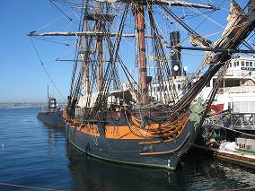
HMS Surprise
Movie fans will love this one! It was a great thrill to stand at the helm of the HMS Surprise just like Russell Crowe did as Captain Jack Aubrey. The HMS Surprise, from the Academy Award-winning movie Master and Commander: The Far Side of the World, was acquired by the San Diego Maritime Museum in October 2004.
The HMS Surprise was originally christened HMS Rose when she was launched in 1970. The 179-foot full rigged ship served as a sail training vessel on the East Coast for over 30 years. The Rose underwent extensive modifications for the production of the film in 2002, in a painstaking effort to recreate a 24-gun frigate from Britain’s Royal Navy. The result is a replica vessel unmatched in authenticity and attention to detail.
It was quite amazing to realize how small and compact the Surprise is, when you consider how many men this type of ship would have carried on board. It’s a lot smaller in person than it looks in the movie. Also, standing at the edge of the ship and seeing how low the sides are, you wonder how the crew kept from falling overboard all the time during rough seas. No safety railings here! Those guys really had to be alert and watch what they were doing while on deck. Then consider all the noise, smoke, and confusion there would have been during battles besides!
The Surprise is kind of like two ships in one. First and foremost, it’s a magnificent replica of an 18th century Royal Navy frigate which will be enjoyed by fans of Master and Commander. When you go below, you can see the cannons, captain’s quarters, displays of uniforms, etc. At the same time, fans of Pirates of the Caribbean will enjoy all of the educational exhibits about pirates.
The “Pirates of the Pacific” exhibit highlights the exploits of William Dampier, a sophisticated buccaneer who mixed an interest in natural science and geography with a lust for adventure. Also learn about Robinson Crusoe, Treasure Island, Chinese pirates, pirate treasures, doubloons, pirate weapons, and much more. There is even a hands-on area with paper, crayons, and samples provided for kids to draw their own pirate flag and treasure map. “Pirates of the Pacific” is a fascinating collection of artifacts, pictures, and displays focusing on these “outlaws of the ocean.”
The B-39 Submarine
The B-39 was built by the Soviets in the early 1970’s and remained on duty by the Russian Federation until the early 1990’s. Its design was based on a World War II era German U-boat, but it was larger and more powerful. The B-39 was 300 feet in length and could carry 24 torpedoes. On active duty for more than 20 years, the B-39 probably tracked and stalked many U.S. Navy ships.
Note: Anyone who has trouble bending, crouching or climbing, or who is uncomfortable in confined spaces (claustrophobic) may have difficulty touring the B-39 submarine. There are several low hatchways to go through, steep narrow stairs/ladders, and cramped tight spaces. Our 16-year-old son who is 6’2” tall had to keep watching his head so he wouldn’t whack it on a low ceiling, doorway, or pipe. The bunks all seemed short, too – I guess a submarine is not the best place for a tall person! Finally when we got down to the engine room he could stand up straight.
Also, if you have a family member who likes to read in the bathroom, he would not be a good candidate for the submarine crew. With 78 men on board, lingering in the “head” was not tolerated. (But the sign didn’t say what they would do to you!) People in our family tend to be late quite often, too, which would not be a good idea on a submarine. In case of emergency, the crew would run through the ship closing and locking the hatches behind them, and they would not be allowed to open them again – no matter who was banging on the other side. So you definitely don’t want to be running late on a sub!
Star of India
I was amazed at how large the Star of India is, especially compared to the Surprise. We boarded the main deck, went up onto an upper deck, went down into a lower deck and then another deck below that. It's long, too, so that ship could hold a lot of cargo! Now it is mostly museum and exhibit space with lots of displays to look at, a children’s education section, as well as having some working and storage areas that are closed to the public.
The Star of India is an iron-hulled ship that was built on the Isle of Man in 1863, when most vessels were still being built of wood. Back then she was called the Euterpe and often traveled to India as a cargo ship. In 1871 she embarked on a new career of hauling emigrants from England, Ireland and Scotland to New Zealand (also sometimes Australia, California and Chile).
From 1902-1923, she was owned by the Alaska Packers who renamed her the Star of India and converted her to a fishing and canning vessel. By 1923, sailing ships had become obsolete and steam powered ships ruled the seas. In 1926, the Star of India was sold to the Zoological Society of San Diego to be the centerpiece of a planned museum and aquarium. But that plan had to be canceled because of The Great Depression and World War II.
For three decades, the Star of India languished in port; it wasn’t until the 1960’s that her restoration began. In 1976, the fully restored Star of India went to sea for the first time in fifty years. The Star of India now sails at least once a year, maintained by a volunteer crew that trains year-round. Star of India is the second-oldest ship afloat, after the USS Constitution (“Old Ironsides”) which is docked in Boston. The Star of India is called the world’s oldest active ship, though, since the Constitution is not in seaworthy condition and just turns around in the harbor once a year.
Did You Know…? The Euterpe (aka Star of India) survived a collision, a mutiny, a cyclone, the death of her first captain on board, and many storms at sea.
The BerkeleyThe
Berkeley is a historically and architecturally unique vessel from the Victorian Age and the golden age of steam. The
Berkeley is one huge ferryboat! Aboard the vessel are numerous exhibits and displays, the museum store, a maritime research library, offices, workshop, model shop, storage areas, and a special events venue with room for 800 guests. Take a 360-degree panoramic virtual tour of the
Berkley:
http://www.sdmaritime.org/berktour/BerkeleyVT.aspDid You Know…? During the 1906 San Francisco earthquake and fire, the Berkeley carried thousands of people to safety.
We spent an average of about an hour on each ship, but by the end the kids were tired and hungry so we were rushing a bit on the last one. It would be nice if they would consider offering individual admissions for each ship so that we could go back to visit our favorite one over and over again instead of having to pay for them all.
Labels: history, Museum, San Diego, ships, virtual tour

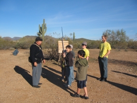
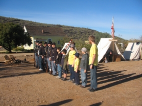 The troops would practice loading their weapons, attaching bayonets, and performing various maneuvers. The boys in our group lined up to drill with the soldiers.
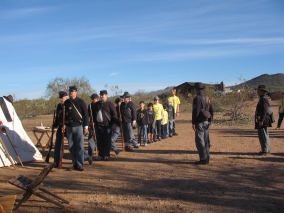 "The first thing in the morning is drill. Then drill, then drill again. Then drill, drill, a little more drill. Then drill, and lastly drill."
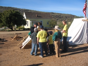 Live demonstrations focused on Weapons, Cooking, and
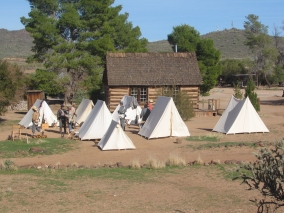
 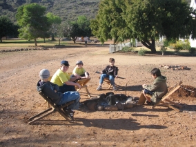 Relaxing around the campfire. When not drilling, standing guard, or faced with the sheer terror of battle, soldiers would spend their spare time reading, writing letters to loved ones, playing cards and other games.
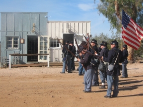 Union troops getting ready for action. It was a great honor to be the flag bearer and when a flag bearer fell in battle, someone else would leap forward to take his place. But their mortality rate was quite high since the goal of the opposing force was to seize the enemies' colors.
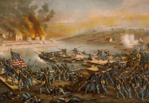
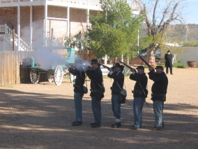 The Union Troops Advance Through Fredericksburg!
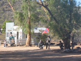 Confederate citizens either went into hiding, ran away, or prepared to defend their homes and businesses as the Union army invaded their town.
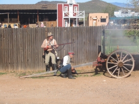 Some of the townspeople got involved in the street fight. (It was an exciting interactive experience for the spectators, too. A gang of boys - mine included! - ran after the Union army, tossing rolled-up newspaper "rocks" at them, but there was so much commotion at the time that I didn't get a picture of that!)
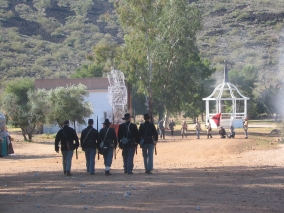 The Confederate troops fall back as the Union army advances. (Newspaper ball "rocks" can be seen on the ground behind them.)
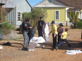 Union soldiers ransacked the town (and got back at the boys who had pelted them with "rocks" by throwing ladies' clothing at them).
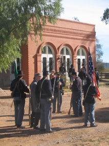 Union troops gathering in front of the bank.
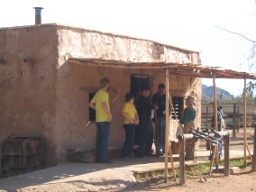 Hanging out at the Sheriff's Office.
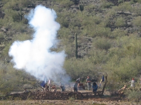 The Union Army's orders were: "Push a column of a division or more along the Plank and Telegraph roads, with a view to seizing the heights in the rear of the town." In the battle of Marye's Heights, Union troops tried to take the hill, but the Confederates were already entrenched behind a stone wall.
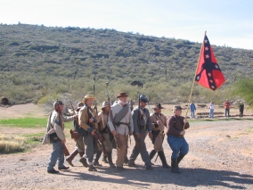 Confederate troops on the march.
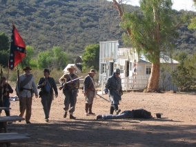 Casualties lying in the street.
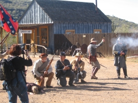


