Educational Adventures in Arizona

Sunday, September 09, 2007

OURAY TO DURANGO ~ September 3, 2007

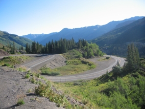
The most spectacular portion of The San Juan Skyway Scenic Byway (US 550) extends from Ouray to Silverton. The route goes by mountain passes, ghost towns, and canyon walls with waterfalls. It’s a paved two-lane highway but it’s slow-going with many sharp curves, switchbacks, steep grades, no shoulders, and an appalling lack of guardrails.

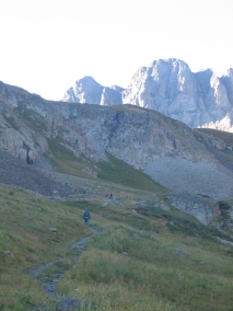
For the first seven miles south of Ouray, the byway follows the Uncompahgre Gorge. You will be driving along the vertiginous edge of a deep canyon the whole way. The weak-hearted should do themselves a favor and don’t look down to avoid having an extreme panic attack. There are several pullouts for stopping to enjoy the breathtaking views if you dare.

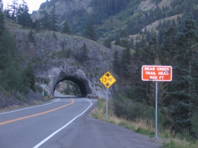
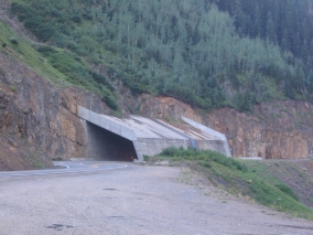
The stretch through the gorge is characterized by steep cliffs with no guardrails, and by the number of hairpin “S” curves used to drop elevation. There is a tunnel to go through, followed by a narrow bridge over Bear Creek Falls, and then the road passes beneath a reinforced concrete snow shed at the deadly Riverside Slide avalanche zone.

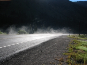
After that you will breathe a brief sigh of relief when you leave the gorge and enter a nice flat valley. It was kind of a weird marshy area, though, with steam rising and strong sulphur fumes – you know, the “rotten egg” smell. We weren’t sure if it was the leachings from a nearby mining operation or naturally occurring swamp gas.

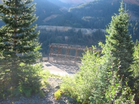
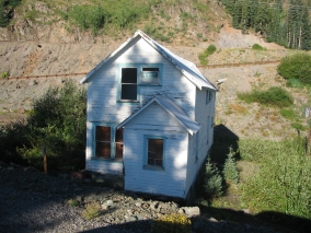
Then the road again ascends several switchbacks past the Idarado Gold Mine. The mine tunnels extend beneath the 13,000-ft. mountains a distance of about five miles to the Pandora Mill near Telluride on the other side. (It would take more than 60 miles to get there by highway!) A portion of the trestle bridge is still standing, extending into thin air. A few houses are also still standing, awaiting renovation by the Colorado Historical Society.

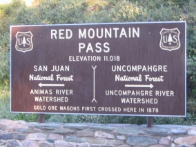
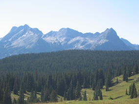
Soon the road crosses Red Mountain Pass at 11,018 feet, providing views of Red Mountain and several ghost towns. The last large scale mine was the Standard Metals operation on Red Mountain Pass which continued until late in the 20th century. From there, the highway descends through another steamy, ghostly valley to Silverton.

South of Silverton, the byway goes over Molas Pass (10,970 ft.) and Coal Bank Pass (10,640 ft.), then parallels the Durango & Silverton narrow gauge railroad track before returning to Durango.

Travel Tip: Driving south on the San Juan Skyway Scenic Byway from Ouray to Silverton puts you on the vertiginous outside edge of the highway; driving north from Silverton to Ouray allows you to hug the inside of curves. Between Durango and Silverton it’s just the opposite. Driving north from Durango to Silverton puts you on the outside edge of the highway; driving south from Silverton to Durango allows you to hug the inside of curves. At first I thought the northbound Durango to Silverton route was scary, but it turned out to be pretty tame compared to the southbound highway out of Ouray, which is mile after mile of sheer terror for anyone who has acrophobia. It gives me nightmares just thinking about it!


Labels: , , ,

MONTROSE TO OURAY, CO ~ September 2, 2007

Driving south of Montrose on Hwy. 550 you will pass through Ridgway. The area was made famous as the filming site of the John Wayne western movie "True Grit." We just missed their True Grit Days which was coming up on the second weekend in September. The True Grit Café is full of John Wayne memorabilia. Ridgway is also home to Dennis Weaver and supposedly Ralph Lauren. It’s a beautifully scenic area with green pastures and trees on the edge of the San Juans, with a spectacular view of Mt. Sneffels. The Uncompahgre River runs through the area and they say that wild animals such as deer, elk, and bear are commonly seen in and around town. Ridgway has a state park and reservoir, both of which have trout fishing. We almost thought about stopping and camping near there, but decided to go a little bit farther to Ouray.

The San Juan Skyway Scenic Byway starts at Ridgeway and heads south through the Victorian mining town of Ouray. The area is known as “Little Switzerland” because of its setting at the narrow head of a valley, enclosed on two sides by steep granite towers and dramatic waterfalls. Ouray has a hot springs as well as an ice climbing park. In addition, the town’s motto is “Jeep Trail Capital of the World” and Ouray serves as a hub to the dramatic Engineer Pass, Cinnamon Pass, Imogene Pass, and the infamous Black Bear Pass. Recording artist Bill Fries, a.k.a. C.W. McCall (and Ouray mayor for two terms) wrote a song called “Black Bear Road” based on the phrase, “you don’t have to be crazy to drive this road, but it helps.” Black Bear is a difficult, dangerous trail even for 4WD vehicles and is travelable in only one direction. The road descends over a series of infamous switchbacks. It takes two hours to drive 12 miles.

Originally established by prospectors who arrived in 1875 searching for silver and gold, at one time there were more than 30 active mines in the vicinity. The town was named after Chief Ouray of the Utes, a local Indian tribe. The entire town is registered as a National Historic District with most of the buildings dating back to the late nineteenth century and many of them also listed on the National Register of Historic Places. Ouray is only about 10 miles from the famous Telluride ski resort, but with the mountains in the way it’s a 60-mile drive to get there. Perhaps due to its isolated location, Ouray is friendly and down-to-earth, with none of the pretentiousness of standard tourist towns. A walk down the main street is an authentic old west experience.

The mountains were misty with rain, and Rich and Pete longed for a nice comfortable rest after their climb. So I suggested getting a room for the night rather than camping out. Even here, most of the hotels were all booked for Labor Day. However, this led us to discover the old Western Hotel dating back to 1892. This structure is one of the few remaining examples of a wood frame hotel from the 1880’s.

Wow, talk about authentic! The lobby looks just like it did in its heyday, with stained glass windows and an ornate tin ceiling still adorned with the original lighting fixture. (One of the world’s first to have alternating current.) After checking in at the historic registration desk, you climb up a steep red-carpeted staircase. Once upstairs, you walk down a creaky narrow hallway where there are a dozen or so small rooms featuring antique dressers, brass beds covered with quilts, and lace curtains fluttering in the breeze. The walls are not insulated, and there is no central HVAC system, not even a window unit. The only way to control the temperature is by opening or closing the window. No phones, no TV, no alarm clock, and the bathroom is down the hall. (Well, actually, the ladies' and gents' toilets are down the hall and the BATH – meaning an old-fashioned footed tub – is in its own separate room.)

At least it beat camping out in the cold and it sure was neat to stay in such an old-fashioned place right out of a classic western movie! Five of us slept in a tiny room with two twin brass beds – two of us in each bed and one on the floor, but that kept us nice and cozy. The proprietor (who also operates San Juan Scenic Jeep tours out of the hotel lobby) caters to hikers and jeepers, so he didn’t mind us bringing in a sleeping bag and pad to sleep on the floor.

It’s a family-owned business, too, with two sons (age 10 and 16) helping out in the dining area, mom and dad in the kitchen, and their little girl (age 6) hanging out with grandpa in the lobby. Grandpa was there until late at night and again at 7:00 in the morning, so I wonder if he lives in his own room at the hotel. Adjacent to the hotel lobby is the saloon with its original carved wood bar, historic paintings (one is an enormous western landscape; the other is a nude woman in a classic pose - just so you know!), and the famous “face on the barroom floor.” Check out their website at www.historicwesternhotel.com.

Labels: , , , , , ,

Saturday, September 08, 2007

LAKE CITY TO MONTROSE, CO ~ September 2, 2007

Lake City was named for nearby Lake San Cristobal. There are quite a few smaller lakes and a stream runs through there, too. We saw lots of beaver dams and lodges. The whole area is picturesque and unpopulated. Lake City is a well preserved turn-of-the-century town. It’s one of Colorado’s largest historical districts, with over 75 buildings from the late 1800’s. I would have loved spending some time walking around Lake City’s charming downtown and admiring its quaint Victorian architecture. As one of the most isolated 19th-century Colorado mining camps, Lake City is still a quiet little town in the middle of nowhere, a perfect getaway destination from civilization.

From Lake City we headed north on Hwy. 149 to Blue Mesa Reservoir. Created by Blue Mesa Dam, the 20-mile long fiord-shaped reservoir is Colorado’s largest body of water, with 96 miles of shoreline. The road skirts alongside of it, so we got to see the lake from one end to the other. The most amazing thing was, on this huge lake hardly anyone was there on a beautiful 70º Labor Day weekend! We saw one sailboat and a few other boats, but Arizona lakes are way more crowded than this one! Their facilities include two marinas, three boat launches, and a National Parks Service visitor center with displays. There are hiking trails, too.

The Black Canyon of the Gunnison begins below Blue Mesa Dam. The deepest and most dramatic section of the canyon is preserved as a National Park. The Black Canyon is so steep and narrow that the walls are cloaked in dark shadows because sunlight doesn’t reach them. The Gunnison has one of the steepest river descents in North America, dropping an average of 43 feet per mile, and as much as 240 feet per mile at Chasm View. (In comparison, the Colorado River through the Grand Canyon drops an average of 7.5 feet per mile.) On the north side of the canyon is Painted Wall, the highest sheer cliff in Colorado at 2,250 feet. There is a scenic drive along the south rim, a campground and several miles of hiking and nature trails. The canyon is also popular with rock climbers. It’s not the place to go if you’re scared of heights, however! We didn’t have time to stop there but I shudder just thinking of it!

Cimarron is a small community on the Cimarron River, just south of the Black Canyon of the Gunnison National Park. We passed by the Cimarron Shooting Club, and a place that resembled a Pioneer Village with old buildings to walk around. From there to Montrose it’s wide open prairie for the most part. Montrose is the largest town in the area. Incorporated in 1882, it became an important shipping center with the Denver & Rio Grande railroad as well as a branch railroad line serving the mineral-rich San Juan Mountains to the south.

Montrose has an airport and is gateway to the world-class ski resort Telluride as well as the exclusive Valhalla Shooting Club & Training Center on the grounds of the five-star Elk Mountain Resort. VSC features a 16,000 square foot indoor pistol facility with a state-of-the-art automated shooting range and a two-story 360-degree live fire scenario house. The computer-controlled lighting, sound effects, and props were created with the assistance of Broadway stage designers. Realistic scenario rooms include a subway station, bedrooms, kitchen, bar, nightclub, industrial area, a warehouse, the first class section and cockpit of an airliner, and many other fully furnished settings.

This is a great concept and it’s worth checking out the video on their website at www.valhallatraining.com, but Valhalla is certainly out of our price range. A lifetime membership costs something like $60,000! (Norman Schwarzkopf and Kareem Abdul-Jabbar are members.) It’s open to day visitors, but members and resort guests have priority. If you were to just take a two-day class it would cost around $500 per person. Then they will let you stay at the resort for a special “reduced rate” of only about $300 per night. There is an on-site restaurant, but even that will average $30/plate. Hmm, is it really a progressive one-of-a-kind educational facility or more like a reality-based playground for the rich and famous?

Labels: , , , , , , ,

Friday, September 07, 2007

HANDIES PEAK, CO ~ September 2, 2007

Since we were camping in the American Basin with tall peaks all around, the sun didn't reach us until 8:30 am. It was 41º when we woke up and later it would get to be 64º. At 10:30 some clouds came by and it got colder and windy, but they blew over quickly and then it was warmer again and sunny. It was so was exciting to finally be at our destination! We had talked about this for weeks and imagined what it would be like, and now here we were finally seeing it in person. The trailhead was just up a little ways at the end of the road, but we packed up our tent and drove the rest of the way so that we wouldn't have to walk any farther than we had to.

I had thought we’d all get at least part way up the trail and perhaps some of us would have to turn back after a while. But when it came time to head out, Josh felt sick and Jon didn't feel good either. I was disappointed that I had to stay down with them and wasn't even able to say that I had attempted to reach the top. Even so, I understood because when I was younger I used to get headachy and nauseous just going up to the higher elevation of Flagstaff, which wasn't nearly as high as we were now. Over the years I eventually grew out of it, and I didn't get a headache the whole time we were in Colorado.

I had brought along ginger cookies and ginger candies, but the kid who should have been eating them didn't like the way they tasted. So Josh kept throwing up all morning, until around noon he finally felt better and we walked along the stream to a waterfall. Jon wasn't too bad, perhaps because of the motion sickness wrist bands he was wearing, but he just wanted to stay in the car and snooze. We were parked near the site of an old mine, although all that was left of this one were some tailings.

Even though we had to wait while Rich and Pete were gone for six hours, the time didn't seem that long. I got the car organized, looked at the map, and watched people come and go. A few climbers had gotten there even before us, but the majority of them came between 9:30-10:00 am. A few others didn't start out till the afternoon. Some people just drove up the American Basin road to look at the scenery or have a picnic and then they left again. A bunch of guys in Jeep Wranglers came by at one point and were tossing a Frisbee back and forth. I overheard them say that it didn't glide as good in the thin atmosphere.

It was funny, Rich and Pete departed from the trailhead at 7:30 am. We were still freezing and bundled up. But at the same time, a group of college girls started up the trail and they were all wearing shorts! The girls were already back down at 11:00 but Pete and Rich didn't return until 1:30. I thought maybe the girls hadn't gone all the way to the top of the peak, but Rich rolled his eyes and said that they had indeed been at the top. People who live in Colorado must be in good shape for that sort of thing, at least as far as their lung capacity goes. Even with all of our hill climbing, we were at a disadvantage coming from a low desert elevation.

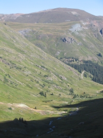
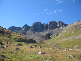
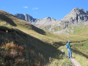
I could only see Rich and Pete going up the trail for a short distance after they left. From the American Basin trailhead, the trail climbs up the grassy slope of the basin towards a ridge immediately in front of us and then zigzags to the left. After that I had no idea what direction they were in or even which peak was Handies, there were so many peaks around there. Apparently Handies looks more like a rounded ridge anyway.

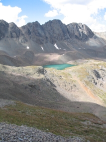
Along the way to Handies Peak, Rich and Pete passed by Sloan Lake, a beautiful alpine lake. Signs at various intervals remind hikers to stay on the trail to avoid erosion of the fragile tundra. Approximately one and one-half miles from the trailhead and just below Sloan Lake, the trail turned to access a moraine ridge.

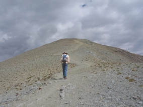
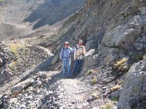
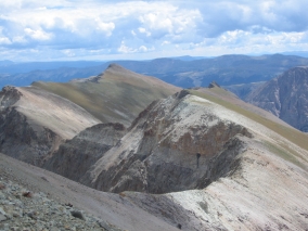
Rich and Pete made it to the top of Handies, so I was glad of that because the whole reason why we had come here in the first place was because of Rich's wish to climb a 14,000 foot peak. Rich and Pete thought they were on a false peak until a guy came by and told them that was THE peak. Rich said the trail had swung around so they must have been close up above us but couldn’t see us. It was like being in the middle of a primitive wilderness, because all they could see were mountains for miles around. Fortunately they took lots of pictures so that I could see what they saw.

According to their GPS, the trail was 2.5 miles long each way. The elevation gain was about 2600 ft. They started out at 7:30 am, reached the summit at 11:30 am, and got back down at 1:30 pm. At 14,048 feet, Handies Peak is among five other 14,000 foot peaks in the area (Sunshine Peak, Redcloud Peak, Uncompahgre Peak, Wetterhorn Peak, and Mount Sneffels), as well as numerous high thirteeners. Rich said that the panoramic view from the top looking out over the sea of San Juan summits that surrounded them was incredible.

As soon as the guys got down from the mountain, we wanted to start heading back because it would be a long drive home. However, we were reluctant to return the same way we came, so we decided to continue east to Lake City. From there we would have to drive north, then west, then south to go all the way around the San Juan Mountain range. Even though it would take us 160 miles out of our way, we figured it would be better than getting stuck forever at that one bad spot.

The road to Lake City is supposed to be a 2-wheel drive road, but the stretch just east of American Basin still seemed awfully rough for passenger cars. It’s a really narrow dirt road, and as we got closer to Lake City we were driving along the edge of a cliff – on the outside edge. Then a car came from the other direction and there was no place to pull off and barely enough room to pass. Yikes! If you’re afraid of heights do not go that way! Haven’t the folks in Colorado ever heard of guard rails?

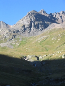
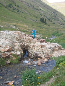
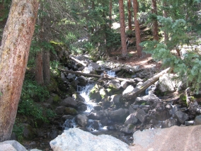
Even the streams and waterfalls in the highly mineralized San Juan Mountains have a silvery appearance.

Additional Information:

http://www.co.blm.gov/gra/gra-american.htm (American Basin trail description and maps, from the Colorado BLM.)

http://14ers.home.comcast.net/redcloud/trip.html (Trip Reports for Redcloud Peak, Sunshine Peak, and Handies Peak.)

http://www.14ers.org/page.php?pname=peaks/sanjuan/handies/standard (Detailed information on the American Basin Route including photos, maps, and elevation profiles.)

http://en.wikipedia.org/wiki/San_Juan_Mountains (An amazing 360° panorama of the southwestern San Juans, photographed from the Gold Hill Ridge of the Telluride Ski Resort. Ridgeline annotation indicates the names and elevations of 43 visible peaks.)


Labels: , , , , ,

LABOR DAY TRIP TO COLORADO ~ September 1, 2007

On Friday night when Rich got home from work, we loaded up the car and took off. Being Labor Day weekend and after a record-breaking month of August with 31 days over 110+ degrees, everyone was heading out of town! The traffic was backed up from Black Canyon City south, which cost us a whole extra hour of driving time.

We went through a few sprinkles when approaching Flagstaff, but it was a beautiful night at our camping spot north of there. We didn’t get to sleep till 11:00 but were already up and breaking camp at 7:00 on Saturday morning. We continued north until we got to Hwy. 160 and headed diagonally across the Navajo Indian Reservation, past the gateway to Monument Valley, and on to Four Corners. This is where the boundaries of New Mexico, Utah, Arizona, and Colorado meet, the only place in the U.S. where four states come together like that.
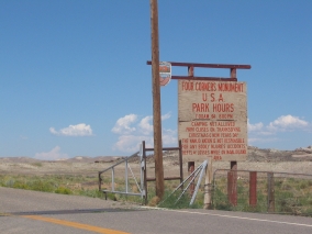
The San Juan River runs through there and that’s where we stopped to have our lunch. We didn’t realize at the time that the water in this river originates in the very San Juan Mountains of Colorado that we were heading for. Since the San Juan is on the western side of the Continental Divide, it flows southwest into New Mexico, past Farmington (where it meets up with its main tributary, the Animas River), northwest into Utah, and west to the Colorado River at Lake Powell near Rainbow Bridge.
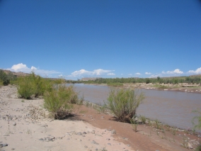
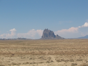
This whole section of the Colorado Plateau is a uniquely scenic area of canyons, red sandstone mesas, buttes, and angular volcanic rocks – including the landmark Ship Rock – rising dramatically 1700 feet above the desert plain.
We briefly drove through a tiny corner of New Mexico before entering Colorado on the Ute Mountain Indian Reservation. We saw the roads leading to Hovenweep National Monument, Canyons of the Ancients National Monument, and Mesa Verde National Park. These are all places that I would love to see, maybe someday. Now we know how to get to them, anyway.
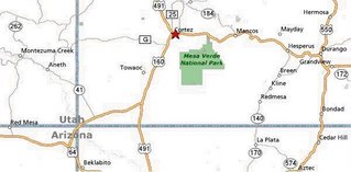
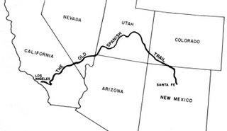
The first town that we came to in Colorado was Cortez. It looked like a nice little farming community. We drove east on Hwy. 160, this portion of which I later found out was The Old Spanish Trail, first used by Juan Maria de Rivera in 1765 and named by John C. Frémont in 1844. The Old Spanish Trail went from Santa Fe to Los Angeles, but strangely enough it bypassed Arizona – going through Colorado, Utah, and across the southern tip of Nevada instead.
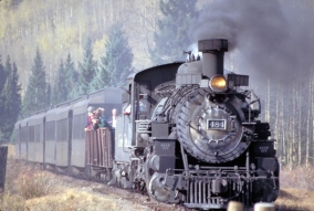
We headed into the mountain foothills and briefly ran through a rain storm. About an hour later we came to Durango, a college town and resort area that reminded me of Flagstaff, AZ. Durango is located in the pretty Animas River Valley. The Durango and Silverton Narrow Gauge Railroad runs along Animas Canyon between Durango and the mining town of Silverton, Colorado. We never saw the historic steam train, but here is a public domain photo of it:
Just like Flagstaff, the area around Durango is an outdoor lovers paradise – whether it’s visiting ghost towns, wilderness trekking, rock climbing, mountain biking, hiking, hunting, fishing, canoeing, rafting, kayaking, and off-roading. Jeeps are more common than ATVs here – they can be seen everywhere! Jeeping is popular on the primitive trails between all of the historic mining camps.

From Durango we drove north on Hwy. 550, a.k.a. The San Juan Skyway Scenic Byway. About 30 minutes north of downtown Durango is the Durango Mountain Resort at Purgatory, which is a small ski area. Despite all the snow, the San Juan Mountains are so steep that the only other ski resort in the area is Telluride, unless you count the cutting-edge Silverton Mountain extreme ski area. It is the highest ski area in North America with the longest drop, and it is also the steepest with no easy way down and requiring all skiers to carry their own avalanche rescue equipment.
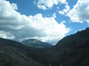
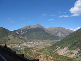
The road from Durango to Silverton goes through alpine meadows, winds around mountainsides, and rises over high passes until it finally reaches the small frontier town of Silverton, a former silver mining camp nestled in a mountain valley surrounded by beautiful peaks. The last large mine closed in 1991. Silverton is now a federally designated National Historic District and tourist destination. At 9,318 feet above sea level, Silverton is also one of the highest towns in the U.S.
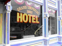
The Silverton Visitor Center is located in a nice old Victorian house painted light yellow. It’s situated in a community park with playground equipment, green grass, and even a paved running track. This was a great stop for the boys after being stuck in the car for hours! Following our time at the visitor center, we ate an early dinner in the historic Gold King Dining Room & Saloon adjacent to the Grand Imperial Hotel (established in 1882) on Silverton’s main street.
The Gold King Dining Room is a fun, family-friendly, smoke-free restaurant (no one was even sitting at the bar when we were there) and they have great food at reasonable prices, too. In addition to the menu items, they offer a weekend Mexican buffet and breakfast buffet, too. The décor includes a moose head, bison head, deer head, stuffed bobcat, and other assorted items of interest for kids to look at. Supposedly, Silverton's Sheriff Bat Masterson left a bullet hole in the ornately carved wooden bar while chasing an outlaw gang.
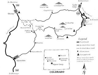
It was good to have a hot meal before heading out onto the Alpine Loop Scenic Byway. We would be driving about 18 miles northeast of Silverton to our camping spot in the American Basin. This portion of the Alpine Loop is a jeep trail suitable for four-wheel-drive vehicles only. (In this case, 4WD vehicles count as “jeeps” regardless of make. We have a Ford Expedition.) The Alpine Loop winds through the heart of the rugged but spectacular San Juan Mountains, between Silverton and Lake City. This road network linking together all of the mining camps was first used in the late 1800’s.
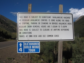
The first part of the Alpine Loop on the outskirts of town was lined with tents and trailers on both sides of the road. I never saw so many people camping in one area! It kind of reminded me of a gypsy caravan. Along the way we also passed by many old mines and dilapidated wooden structures – some of which were already collapsed and others which looked unstable to the point of being ready to fall down at any time.
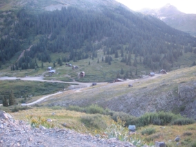
I always thought that Arizona had lots of ghost towns, but unfortunately nothing remains of most. I was surprised to see more real historic western structures still standing in the mountains of Colorado than there are in Arizona – including an entire abandoned townsite called Animas Forks! This is right near where the Animas River begins. Interestingly, its full name is El Río de las Animas Perdidas, or the River of Lost Souls. Read more about the living history of Animas Forks here: http://www.blm.gov/education/feature/1999/co/
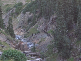
We even saw an old wooden footbridge over a ravine with the boards still dangling there, as if straight out of an Indiana Jones adventure. Sadly, we didn’t have time to stop and explore because sunset was approaching and we had to find our camping spot.
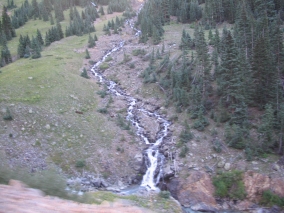
Another neat thing about Colorado was that there was water everywhere in the form of mountain streams, lakes, and waterfalls. As we rounded a bend near Cinnamon Pass, the next amazing sight we saw was snow! While in Arizona it was a hot 110 degrees, here in the high mountains of Colorado it was cold enough to have snow – even in August!
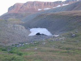
We’re used to driving on high-clearance jeep trails in our Ford Expedition. What we didn’t know was that the steep, narrow dirt roads of the Alpine Loop had suffered some serious damage as the result of heavy winter snows and summer rains. There are plenty of ruts and pretty good washouts in various places, with caution cones blocking off eroded sections along the edges of sharp dropoffs. This meant that its “hardness” rating as a 4WD road had increased significantly compared to previous descriptions we had read on the internet.
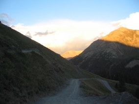
It was slow-going and scary sometimes because of the narrow steep road – there are plenty of places where you wouldn’t want to run into someone coming from the opposite direction! – but we did pretty well all the way past Cinnamon Pass at 12,640 feet. At that point, we had actually driven higher than the tallest mountain in Arizona. Then we came to a really sharp hairpin turn at a steep angle over protruding rocks with a rut in the middle. The rest of us got out of the car while Rich carefully nudged it over that spot.
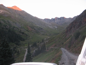
There were still people camping all along the way although the farther in we went, the less populated it was. The sun was going down when we finally found the American Basin turnoff. We set up our tent in a grassy meadow beside a gurgling mountain stream. I kept waking up at night and feeling a little queasy, but wasn't sure if it was due to the altitude (11,600 ft.) or the sound of the water making me seasick! I felt fine when I got up in the morning, though.


And no wonder there was snow up there, we were freezing that night! At least our sleeping bags kept us cozy. It was 41 degrees when we ventured out and checked the thermometer, so it may have been even colder during the wee hours of the morning.

Labels: , , , ,

TO CLIMB OR NOT TO CLIMB...

Believe it or not, for the last couple of months our family has been in training for hiking up a high mountain. You see, my husband had this dream of climbing a 14,000-foot peak before his 50th birthday. He can never find anyone who wants to go with him. Time was running out, but I didn’t want him going alone either. So I thought, let’s all go and this way the whole family can share in his triumph.

I researched all of the 14,000 foot peaks that are closest to Arizona and actually found one in Southwestern Colorado where the trailhead starts out pretty high up. On some other peaks you have to hike 6-11 miles one way! This one was a short distance of only about 2 miles. Thus, our destination would be Handies Peak in the San Juan Mountains, part of the Rocky Mountain range.

The San Juan Mountains of southwestern Colorado contain some of the state's most wild and rugged mountains, as well as some of the finest old mining towns in the West. The San Juan range is part of the Colorado Mineral Belt and featured prominently in the early days of gold and silver mining. Major towns in the area, all old mining camps, include Telluride, Silverton, Ouray, and Lake City. This was going to be a real adventure because none of us had ever been to the Rockies before.
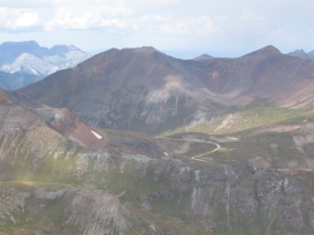
To begin preparing for the trip, my husband and our 17-year-old son hiked up Humphrey’s Peak, the tallest mountain in Arizona at 12,633 feet. A few weeks after Rich and Pete climbed Humphrey's Peak, the rest of us went up there. Joshua (7) and I actually made it halfway to the top! Then Josh got tired and couldn’t go any further. I carried him all the way back down on my back - kind of like carrying a 50-pound pack!

The purpose of this climb was to see how far everyone could get, and we made it to the 2-mile mark which is the distance to the top of Handies Peak, so we were fairly hopeful. Every night after that, we ate a light dinner and then went walking up a steep hill near our house to get in shape. We were all pretty psyched about doing this. The only uncertainty was how we would fare at the much higher altitude in Colorado.

Labels: , , ,